A website devoted to demonstrating the outstanding natural beauty and lifestyle of Northumberland, Northern England and Newcastle.............
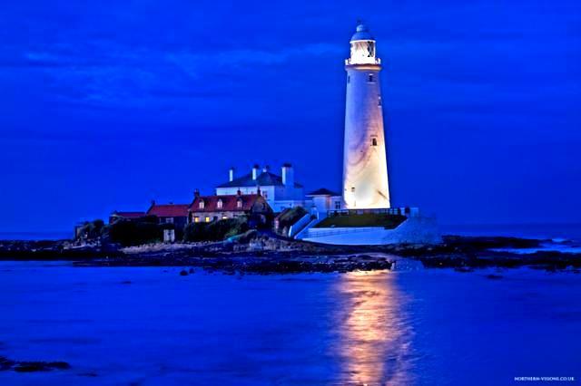
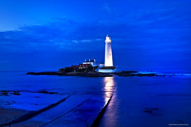

St Marys Lighthouse is one of the most recognisable features of the North East coast line. It has appeared on nearly every publication, postcard and poem since it was constructed in 1898.
The island itself has played an important part in the regions heritage. It was the home to hermits and Monks, from approximately 800ad, and up until the Norman invasion of 1066, where the nearby Monastery was constructed. And it remained so up until the time of the Dissolution of the Monasteries in 1580's.
Since then the Island known as Bait Island, was used for everything from smuggling, to fishing. And the local St Marys bay, was the landing spot for the smugglers. Who were thought to hide the contraband in Hay Bailes on the Links.-
There has always been a lighthouse of some sorts, before this one there was a smaller lighthouse, which was a beacon, with a oil lamp. But it is thought that centuries previous, there has been some sort of warning to shipping.
The current lighthouse was decommissioned in 1984, and has stood as a local landmark, and visitor attraction ever since.
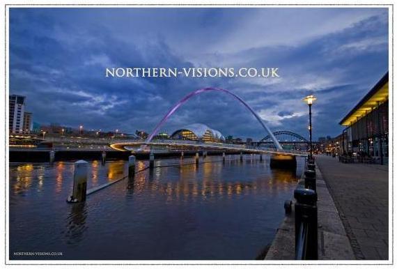
Newcastle and Gateshead's Millenium Bridge and Quayside.
This is one of the more popular places on the Quayside for a good night out.
Over the Next few months and years I will be adding shots to this page that signify the North East of England and Northumberland.
In all areas of the world there are certain things that signify where you are, or where you were when you seen that building, bridge, view or scenic spot.
So when I am on my travels, I will endeavour to highlight some of the more memorable places, and architecture etc, that graces the North East of England and Northumberland.
Paul
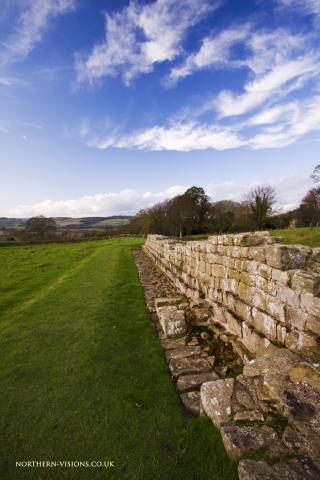
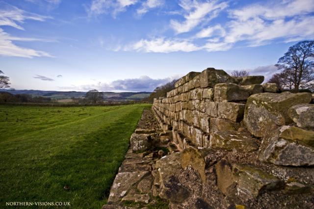
This is the remains of Hadrian's Wall near St Oswald's Church Northumberland. A terrifying 3 ft remnant of the roman Empire, impervious to all but the tallest barbarians.
This is one of the many remnants of the once mighty Roman Fortification built in the time of the Emperor Hadrian, to mark out the Northern Border of the Roman Empire.
The wall was first constructed in the year 122 AD, and took about 6 years to complete. There is evidence to suggest the first wall was made of earth and wood. And over the years this gave way to the stone wall you see now.
The reason for building the wall is still controversial. Some say it was to define a "border" to the Empire, and give it a strict line on a map to say this is where civilisation ends. Where as others can say it was to keep the Barbarians out of the empire from the untamed lands to the North. Especially since the Romans did not have much success in conquering what is now Scotland.
But since there were many gates in the wall, the Empire could levy a tax on people crossing the border, what we now have as customs. This brought in a lot of gold to the local Garrisons.
The wall starts over in Carlisle, on the Solway Firth, and ends in Segadenum, which is now conveniently called Wallsend. It stretches approximately 80 miles, and is south of the current Scottish Border by 15 miles approximately.
The wall was constructed in a very orderly and purposefully build way. Every mile, as the name suggests there would be a "Milecastle". This would contain part of the Roman Legion that was assigned to guard that section of the wall. Every half mile between the Milecastles, there would be a smaller observation tower. Again containing soldiers from the local legion.
The wall also had defensive structures as follows.
* The wall itself was about 10ft high, built on cliffs or bluffs where possible.
* A Glacis ( an inclined turf mound up to the wall )
* A deep ditch called a Vallum in front of the wall
* A berm with deep pits containing entanglements for approaching soldiers
* A curtain wall
* Later a Military road, which still exists to this day. To facilitate troop movements.
* A north mound and south Mound to prevent a Northern or Southern tribe attacking the wall.
The wall itself was supported by many Forts. Such as Housesteads etc. These were like small towns, and contained all the paraphernalia that comes with a garrison of 10,000 men guarding the wall. Housesteads fort is still remarkably well preserved, and all the amenities there are surprising even today. Bath houses, running water, underfloor heating to name but a few. They rally were ahead of their time.
The wall lasted for many years, and even though eventually the wall was guarded by reserve troops, not front line troops, it remained manned until 138AD. Where the new Emperor Antonius Pius built a new wall much further North into Scotland. Called the Antonine wall.
This all remained until 410AD when the Romans left Britain, and after they departed the wall fell into disrepair. But given how cold and wet in can be round here at times, I would think some of the poor sods that used to man the wall, and were from warmer climates might not of shed too many tears about it! I mean can you imagine coming from Spain, Italy or the Far East and being posted to a place as cold as this place is in winter! Wearing what they did too!
Many of the dry stone walls and old houses are made from the stone of the wall. An unthinkable thing nowadays, but in the middle ages etc, material was there to use. And given how cold and remote it can get here needs must I guess.
The wall was recently given world heritage status. So it makes a fantastic route for walkers and tourists alike.
Hadrians wall .......
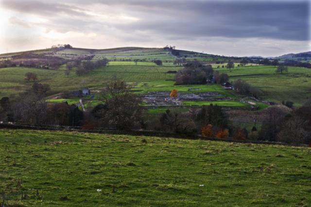
Vindolanda Roman Fort on Hadrian's Wall.
This fort has been in existence since 85 AD, since the Romans conquered the tribe that was local to this at the battle of Mons Graupious. In the early days the fort was made of timber. And had to be replaced fairly quickly given the weather and activity at play on it.
In the latter days of the fort, all wooden structures were transformed into stone. But as was the Roman custom all previous foundations were covered over in clay and turf. This has had an unexpected bonus, since there is no air, an anaerobic environment was created around relics that are buried in the ground.
There have been old tablets discovered with letters to family, garrison business, gold, silver, leather all sorts found on the site.
There is always some form of excavation going on, and the finds keep coming up. The on site museum is a fascinating day out.
They have built 2 forts, one from wood and one from stone. To show what they looked like in that period.
Vindolander is situated between Chesters and Housesteads on the Military Road, the B6318.
